

CONFERENCES
EuroCarto 2024
Vienna, 8 – 11 September 2024
NAVIGATING THROUGH HISTORY: DEVELOPMENT OF UNITS OF LENGTH IN NAUTICAL CHARTS DEPICTING THE ADRIATIC SEA, CA. 1270–1824
Julijan Sutlović
The Mediterranean Sea is a crucible where diverse cultures, geopolitical strategies, and economic interests converge, highlighting its significance for interdisciplinary studies. The Adriatic Sea, a crucial part of this region, shares similar developmental challenges with the wider Mediterranean area, particularly in the context of maritime navigation—a practice deeply rooted in the basin for millennia. This research aims to scrutinize the map scales and units of measurement employed on nautical charts of the Adriatic Sea, spanning from approximately 1270 to 1824, to assess their effectiveness in conveying essential navigational information. This study meticulously reviews a corpus of 84 nautical charts of the Adriatic and the Mediterranean Sea, employing a systematic and thorough methodology to document all identified scales and corresponding units of length. These findings were cataloged in tabular form to facilitate comparative analysis. Employing chronological ordering, the historical development and quantitative application of these measurement units on the charts were traced, enabling the visualization of their historical development over time in both qualitative and quantitative terms. An extensive literature review supported the identification of specific units of length depicted on individual charts. By analyzing the units of length, considering information about the quantity of measurement units within one degree of the great circle, it was assessed whether cartographers accurately linked specific scales to corresponding units. A detailed review of the scales and measurement units on the charts provided a comprehensive overview by number and type of length units for each analyzed chart. Charts that lacked explicitly stated measurement units but included a linear scale were assumed, based on the literature, to relate to the portolan mile. The scale on the charts could be used in various ways. Namely, during the late Middle Ages and early Modern Period, a linear scale could be converted into a numerical scale, calculated using the length values of a degree if a graticule was present on the chart, and compared with another map of the same area but different scale. It could also be used with a caliper to determine the distance between points. To do this, it was necessary to know the length of a specific unit and which length of a unit the cartographer had in mind, as cartographers often incorrectly named certain units. The lengths of units changed during time; for instance, Cardarelli (1997) asserts that the length of the lieue de Paris was equivalent to 1,666 toises or 3,247 m in 1674, in the period from1674 to 1737 its length was 2,000 toises or 3,898 m, and in the period from 1737 to 1794 its length spanned to 2,280toises or 4,444 m. Similar changes happened with other studied units of length. During the early Modern Period, cartographers used a significant variety of units of length on linear scales. On manuscript charts, cartographers generally did not assign a measurement unit to the linear scale. The most commonly used units of length, on early Modern Period charts, were the Italian, German, and Dutch miles, and the Spanish, French, and English leagues. The geographical specificities of those units were also considered, indicating the international usability of the charts. Based on the studied corpus, it can be concluded that cartographers had problems with the terminological definition of "mile" and "league," often using these concepts interchangeably. Problems with the terminology of measurement units and equating miles and leagues as synonyms are examples of how semantic confusion can affect the interpretation and use of cartographic information. This issue could have also had practical consequences for maritime navigation. The results of this research are expected to enrich the existing knowledge on the history of map scales and the units of length used on them.

Seventh Congress of Croatian Historians,
Osijek, 25 – 28 September 2024
GENEZA KARTOGRAFSKOG PRIKAZIVANJA JADRANSKIH OTOKA OD 14. DO 18. STOLJEĆA / GENESIS OF CARTOGRAPHIC DEPICTIONS OF ADRIATIC ISLANDS FROM THE 14TH TO THE 18TH CENTURY
Milorad Pavić
Kartografsko prikazivanje jadranskih otoka imalo je, u odnosu na općenite značajke kartiranja tijekom ranoga novog vijeka, određene specifičnosti koje su proizlazile iz pomoračko-plovidbene perspektive. Kartografija je po pitanju prikaza obale i otoka imala dva razvojna pravca. S jedne strane karte baštinjene na antičkoj tradiciji s matematičko-kartografskom osnovom, a s druge strane tipične pomorske karte pragmatične naravi s kompasnim ružama i rumbima koji olakšavaju navigaciju. Obje tradicije pokazuju znatne manjkavosti, a tek njihovim zbližavanjem početkom 19. stoljeća dolazi do napretka u kvaliteti kartografskog prikazivanja otoka. O tome kako je neki jadranski otok bio percipiran te prikazan ovisilo je o njegovu izgledu pri čemu se misli na odnos njegove širine i dužine te njegovu obalnu i vertikalnu razvedenost, smještaju uz važniji plovidbeni pravac ili izvan njega, ali i o hidrografsko-maritimnim značajkama.
The cartographic representation of Adriatic islands possessed certain specific features, compared to the general characteristics of early modern cartography, which stemmed from a maritime-navigation perspective. In terms of depicting coasts and islands, cartography evolved along two main lines: on the one hand, maps inherited from the ancient tradition with a mathematical-cartographic basis, and on the other, typical nautical charts of a pragmatic nature, featuring compass roses and rhumb lines that facilitate navigation. Both traditions exhibited significant shortcomings, and only their convergence at the beginning of the 19th century led to advances in the quality of island mapping. How a particular Adriatic island was perceived and depicted depended on its appearance—namely, its width-to-length ratio, coastal and vertical complexity, and its location in relation to major shipping routes or off these routes—as well as on its hydrographic and maritime characteristics.

20th International Conference on Geoinformation and Cartography
Zagreb, 5th – 7th September 2024
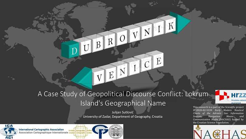
CASE STUDY OF GEOPOLITICAL DISCOURSE CONFLICT: LOKRUM ISLAND'S GEOGRAPHICAL NAME
Julijan Sutlović
The conflict of geopolitical discourse is vividly illustrated through the examination of various geographical names assigned to Lokrum Island on early modern nautical charts and in navigation guides. By delving into the geopolitical dynamics between the Republic of Venice and the Republic of Dubrovnik, this research underscores how geographical names (toponyms) not only reflect but also shape territorial ambitions and political narratives. The study employs a comparative qualitative analysis of historical cartographic sources and navigation guides, utilizing an interdisciplinary approach that integrates contemporary research paradigms such as border studies, imagology, cultural geography, and geopolitical discourse. This approach allows for an in-depth exploration of how toponyms function within the broader context of political ideology and cartographic tradition. Particular attention is given to the role of toponyms as instruments of political and cultural hegemony, demonstrating how powerful states like the Republic of Venice used cartography as a means to legitimize their territorial claims. The analysis shows that cartographic representations actively contribute to the construction and perpetuation of ideological narratives. The island was named with multiple names, such as lacroma, croma, and similar names, and Scoglio di San Marco. The findings reveal that renaming Lokrum Island was a strategic tool for asserting dominance and shaping political discourse. The name Scoglio di San Marco was carefully chosen to assert control and influence over the island. This research contributes to the broader understanding of how cartography and toponymy function as instruments within geopolitical discourse. It provides insights into the geopolitical processes through which cartography and place names are used to assert power and control, ultimately enriching comprehension of geopolitical strategies and their historical roots.
Early Modern Nautical Charts: Information Sources, Navigation Means and Communication Media
Zadar, 23-24 May 2024
EARLY MODERN NAUTICAL CHARTS OF THE ADRIATIC SEA AS A MEDIUM OF COMMUNICATION
Julijan Sutlović
Maps are representations of multiple values. Every map can be considered a medium of communication about space and a medium of communication in space. This communication involves the map’s creator, who, by shaping its content, conveys appropriate messages to the map’s users that frequently go beyond geographical discourse, such as the need to explain to the map user where the locations of objects are and what the spatial relationships are between the objects and phenomena it depicts. The reception and dissemination of those messages depend on the competency profile of the map user as well as on the cultural, social, and political background in which the map is interpreted and used as a source of knowledge about the represented space. Nautical charts are specific map types on which the coast and island representations are the focus, along with navigational systems of various spatial coverage. They serve as essential navigational aids while conveying complex symbolism, making them multi-layered communication tools. Using numerous early modern nautical charts depicting the Adriatic Sea as research objects, determining their communication aspect will be made in light of the political and cultural contexts in which the Mediterranean and Adriatic Sea maritime affairs acted as carriers and catalysts for socio-economic development during the early modern period. The diachronic comparison of charts provides an insight into space and the phenomena that occur in it, allowing the determination of the dynamics of charts as a medium with a wide range of communication potential and possibilities.
KEYWORDS: nautical charts, Adriatic Sea, communication, early modern period

Early Modern Nautical Charts: Information Sources, Navigation Means and Communication Media
Zadar, 23-24 May 2024
COMMUNICABILITY OF THE SYMBOLISM OF ARTISTIC ELEMENTS ON NAUTICAL CHARTS OF THE ADRIATIC SEA
Lena Mirošević, Dubravka Mlinarić
Maps graphically represent the spatial relationships of the earth and can be regarded both as a complex communication medium and as an instrument for conveying selected messages. The composite anatomy of maps consists of various multi-structural elements such as scientific, mathematically based pictorial records, artistic (decorative) additions and pure embellishments, or a structural combination of both. The aim of the paper is to re-examine the role of cartographic decorative and imagological elements (signs and images) of the Adriatic Sea on early modern nautical charts. A further task is to evaluate the communicative capacity of the maps as carriers of ideological, political, cultural, or other symbolic messages.
The principle of analogy was applied to the iconographic or imagological interpretation on the basis of selected examples (40 in total) of nautical charts of the Adriatic of different provenances (mainly of Venetian origin), whereby a decomposition, i.e., a deconstruction, of the old nautical charts is also possible.
The artistic features of the cartographic content on the nautical charts of the Adriatic, such as compass roses, graphic elements of sailing ships, saints, animals, or depictions of people, are therefore compared analytically in order to show the variety of messages they convey.
Maps served as an important means of communication between different actors and played a role in the assertion of state interests, whether through the production and presentation of knowledge about a particular space or territorial control and power (Wintle, 1999; Brunn and Dodge, 2017). Consequently, until the early modern period, the production of cartographic knowledge was largely controlled, selected, organised, and distributed according to certain specific procedures (Harley, 1988). In the case of 16th and 17th century maps in Europe, the methods of control were evident through strategic secrecy, economic secrecy, or a combination of both.
To understand the content and conceptual basis of a map, it is necessary to place it in the social and historical background or context in which it was created, circulated, and utilized. Recognised components of symbols (hidden or overtly represented) from different origins will be related to each other in order to identify the variety of messages they potentially convey and the cultural background of the selected artistic representation, as well as the traces of shared and communal practices in the production of maps in different cartographic traditions.
KEYWORDS: nautical charts, the Adriatic, early modern period, artistic elements, symbols

Early Modern Nautical Charts: Information Sources, Navigation Means and Communication Media
Zadar, 23-24 May 2024
RELIGIOUS SYMBOLISM ON OLD NAUTICAL CHARTS OF THE ADRIATIC SEA
Josip Faričić
During the Middle Ages and the early modern period, religion exerted a great influence on European society and permeated various aspects of life. This influence went beyond traditional religious practices and shaped the perception of spatial reality, from cosmological thoughts to governance on a micro-regional level. As a result, sacred elements became an integral part of the cultural landscape and manifested iconographically in literary and artistic creations. This influence is evident in the Adriatic Sea's nautical charts from the thirteenth to the nineteenth centuries. An analysis of around one hundred nautical charts depicting the Adriatic region identified a wealth of religious symbols. These symbols are primarily rooted in Christianity but occasionally also contain Islamic motifs and reflect the historical coexistence and occasional conflict between the two religions in the Mediterranean. With the advent of the Renaissance, there was a revival of interest in ancient cultural and scientific paradigms, including classical Greek and Roman religions and mythologies. Consequently, the iconography of these traditions found its way onto nautical charts, which often served decorative purposes but also conveyed various messages to sailors and other users of these charts. This composite of religious iconography from various traditions led to a symbolic syncretism on nautical charts, reflecting the continuous cultural sedimentation and permeation in the Adriatic region.
KEYWORDS: nautical chart, religion, symbolism, Adriatic Sea, Mediterranean

Early Modern Nautical Charts: Information Sources, Navigation Means and Communication Media
Zadar, 23-24 May 2024
MEDIEVAL VS. EARLY MODERN ICONOGRAPHIES OF THE CARTOGRAPHIC REPRESENTATION OF THE ADRIATIC REGION
Palmira KrležaLovrić, Dubravka Mlinarić
The interdisciplinary study of the iconographic communication potential of maps and nautical charts of the eastern Mediterranean, especially in retrospect from the Middle Ages to the early modern period, is a relatively under-researched topic, not only in the context of historical cartography. However, a few valuable results, especially from imagological and iconographical studies carried out in the context of social and art history, have shown the versatility and complexity of their manifestations.
This paper will briefly present the results of the comparison of some prominent medieval cartographic sources of the Adriatic Sea with selected early modern sources, in order to demonstrate the iconographic communication possibilities of semi-navigational or non-navigational decorative visual elements, primarily from the perspective of art history.
Regardless of their origin, function, or provenance, these nautical charts consisted of the usual and expected geographical data and/or cartographic content. In addition, they contained rich and high-quality illustrative components of various kinds, with lush aesthetics and sophisticated symbolism. The iconographic analysis of the visual images depicted on selected maps and charts will reveal part of their potential as a means of communication, as they have always served as historical evidence of a very turbulent and complex period in the history of Croatian lands. Since maps and charts reflect influences due to the complex social interactions and differences between Southeastern Europe and Central or Western Europe, it will be particularly valuable to compare the different perspectives of the Eastern Adriatic from the point of view of different cartographic traditions (Venetian, Ottoman, and Dutch). Cartographic approaches and influences depended, among other things, on political affiliation, religion, class status, culture, ethnicity of the cartographic authorities, economic or political power of the mapmakers, etc. However, due to its position “between the crescent and the cross”, the focus will be on the cartographic conflict over the Adriatic between the interests of Venice, the Habsburg Monarchy, and the Ottoman Empire. In addition, the paper will question the image of the Adriatic as an “unknown” land or as the territory of the “Others”, which was repeatedly disseminated by Dutch mapmakers, for example.
With regard to nautical charts as visual images or representations, means of communication, and dissemination channels or media, a number of complex symbols depicted on medieval (mappae mundi) and early modern maps and nautical charts have already been studied as a part of the research activities of the NACHAS project. These include, in particular, the earliest maps and imaginaries of the New World seas produced by Piri Reis and Juan de la Cosa. This paper attempts to scale down the same phenomena and trace the same elements on the nautical charts of the Adriatic. Applying the same methodology to the more specific material of early modern maps and nautical charts of the Croatian sea areas, this qualitative analysis will focus on the most common decorative elements. Representations of ships, flags, and religious images, but also, when present, ethnographic elements or fauna are compared in order to decipher their different, mainly symbolic meanings as they were understood in the imagological communication code of the time.
KEYWORDS: Medieval Period, Early Modern Period, Cartography, Eastern Adriatic, Iconography

Early Modern Nautical Charts: Information Sources, Navigation Means and Communication Media
Zadar, 23-24 May 2024
NAVIGARE ET REGERE. THE VENETIAN CARTOGRAPHY THROUGHOUT THE CENTURIES: FROM PLANNING TOOL TO SYMBOL OF POWER
Orietta Selva, Dragan Umek
Navigare et regere are two key words that well summarise the fundamental uses and values that the Serenissima has always attributed to its cartographic production.
This presentation aims to provide brief reflections on the Venetian cartography through some historical documents drawn up between the XVI and XVIII centuries, paying particular attention to the different features assumed in relation to cultural contexts, political situations, economic needs, interests related to navigation, control, and management of specific territorial areas, as well as the definition of new urban layouts.
In fact, the Venetian cartographic manufacture includes various iconographic typologies ranging from the well-known nautical charts to territorial, administrative, and micro-area maps, each suitable for performing one of the multiple functions of the state. In this way, the cartographic document is used not only as a tool for territorial governance but also as a means to certify and self-celebrate the monopoly, the power, and the greatness of the Venetian Republic, as the words “Golfo di Venezia ovvero Mare Adriatico” testify, even years after its “fall” in 1797.
KEYWORDS: cartography, Republic of Venice, sea, land

Early Modern Nautical Charts: Information Sources, Navigation Means and Communication Media
Zadar, 23-24 May 2024
CREDIBILITY OF THE MAPS OF THE ADRIATIC ISOLARII IN THE SIXTEENTH CENTURY: CREATION OF DIFFERENT GEOGRAPHICAL IDENTITIES
Milorad Pavić
Isolarii or literary depictions of islands, are a genre of scientific travelogues in which texts describe the islands and parts of the water area through texts and images. Originally created in Venice at the dawn of the early modern century, they have great significance as a source of knowledge of the Adriatic basin, primarily its insular part. The accuracy of their maps or tables in the 16th century depended on several factors: the level of previous geographical knowledge, heritage from the classical period, the medium of presentation and the way of presenting their content. Due to the lack of information, many authors have resorted to the works of their predecessors in their works, building them up with new knowledge while at the same time spreading some inaccurate established stereotypes. Besides these factors, there were also numerous others where the authors consciously sacrificed the accuracy of the presentation, primarily due to pragmatic reasons, thus creating a new and different geographical reality, thereby affecting the perception of the Adriatic area at that time.
KEYWORDS: Adriatic isolarii, nautical charts, geographical identities, sixteenth century, perception of Adriatic area

Early Modern Nautical Charts: Information Sources, Navigation Means and Communication Media
Zadar, 23-24 May 2024
THE IMPORTANCE OF CARTOMETRIC ANALYSES FOR STUDIES RELATED TO THE HISTORY OF CARTOGRAPHY: THE EXAMPLE OF THE ADRIATIC SEA BASIN
Tome Marelić
The roots of cartometric studies can be traced back to the late nineteenth century and the work of Hermann Wagner (1869), in which he examined the geometry of two portolan charts and coined the term cartometric as well. Computer-aided tools have come a long way in the last few decades, making it much easier to analyse large amounts of quantitative data that can be extracted from charts and maps. However, the amount of research that has been done on cartometric studies is still much smaller than the amount of research that has been done on descriptive studies. A sample of early modern nautical charts and geographical maps on which the Adriatic Sea basin is displayed was subjected to several different cartometric approaches (methods) in order to demonstrate and discuss their mandatory and desired prerequisites, the significance of the input-data-redundancy, the influence of pre-determined parameters on the research-outcomes, and the importance of the historical context in terms of objective interpretations of the results and the conclusions derived from them.
KEYWORDS: cartometric analysis, early modern charts and maps, Adriatic Sea

Eighth Croatian Geographical Congress
Malinska, 4th – 6th October 2023
KARTE I GEOGRAFSKA STVARNOST: PRIMJER STARIH GEOGRAFSKIH I POMORSKIH KARATA JADRANSKOG MORA / MAPS AND GEOGRAPHICAL REALITY: THE EXAMPLE OF OLD GEOGRAPHICAL MAPS AND NAUTICAL CHARTS OF THE ADRIATIC SEA
Josip Faričić
Komparativnom analizom stotinjak starih geografskih i pomorskih karata, primjenom dekompozicije, odnosno dekonstrukcije istražena je percepcija stvarnoga geografskog prostora. Utvrđeno je da su na tu percepciju utjecali: način prikupljanja prostornih podataka, obujam i kvaliteta geografskih spoznaja te perspektive iz kojih se jadranski prostor promatrao. U različitim percepcijama Jadrana moguće je prepoznati različite ideje, koncepte, diskurse i predrasude (npr. u pogledu prostorne organizacije na relacijama jezgra – periferija, Mi – Drugi, Istok – Zapad i dr.). Na starim su kartografskim prikazima Jadrana iskazivane namjere autora ili naručitelja karte zbog kojih se kao komunikacijski alat upotrjebljavalo sugestivno generaliziranje, naglašavanje ili pak prešućivanje pojedinih elemenata geografske stvarnosti te unošenje ikonografskih elemenata koji su, noseći bogatu simboliku, nadilazili estetsku (dekorativnu) funkciju. Stare karte Jadrana dobar su primjer svojevrsnoga kontrapunkta između stvarnih i imaginarnih sadržaja koji se isprepliću čineći složene kompozite u kojima je moguće iščitati mnogo više nego li se postiže suhoparnom interpretacijom onoga što je i gdje je na njima prikazano.
Through a comparative analysis of about one hundred old geographical maps and nautical charts, applying a method of “decomposition” or deconstruction, this study investigates how real geographic space was perceived. The findings indicate that this perception was influenced by methods of collecting spatial data, the scope and quality of geographical knowledge, and the perspectives from which the Adriatic region was observed. Different perceptions of the Adriatic reveal a variety of ideas, concepts, discourses, and biases (e.g., regarding spatial organization along core–periphery lines, “us” vs. “others,” East vs. West, etc.). On old cartographic representations of the Adriatic, the intentions of the cartographers or those who commissioned the maps are evident. As a communication strategy, they employed suggestive generalization—emphasizing or downplaying specific elements of geographical reality—and introduced iconographic features whose rich symbolism transcended mere aesthetic (decorative) purposes. Old charts of the Adriatic serve as a striking example of the interplay between actual and imagined content, interwoven to form complex composites that reveal far more than can be gleaned from a straightforward interpretation of what is depicted and where it is shown.

Eighth Croatian Geographical Congress
Malinska, 4th – 6th October 2023
RETORIKA DEKORATIVNIH ELEMENATA RANONOVOVJEKOVNIH KARTOGRAFSKIH PRIKAZA JADRANSKOG MORA / THE RHETORIC OF DECORATIVE ELEMENTS IN EARLY MODERN CARTOGRAPHIC REPRESENTATIONS OF THE ADRIATIC SEA
Lena Mirošević, Dubravka Mlinarić
Dekorativni elementi na ranonovovjekovnim kartografskim prikazima Jadranskog mora imali su posebnu retoriku. Cilj istraživanja bio je procijeniti komunikacijski kapacitet kartografskih prikaza kao nositelja ideoloških, političkih, kulturnih ili drugih simboličkih poruka. Kvalitativna analiza simboličkih elemenata na kartografskim prikazima Jadranskog mora različitog podrijetla (prvenstveno venecijanskih) kao što su kompasne ruže te slike jedrenjaka, svetaca zastava, grbova i životinja u radu će biti analitički uspoređena kako bi se otkrila raznolikost poruka. Simbolički elementi na kartografskim prikazima Jadrana u ranom novom vijeku svjedočanstvo su kulturne i vjerske pripadnosti Jadrana europskom navigacijskom bazenu, odnosno kršćanskom kulturnom arealu te sugeriraju šire imagološke i komunikacijske kapacitete kartografskih medija usmjerenih na znatno širu (ili drugačiju) publiku od pomoraca.
Decorative elements on early modern cartographic depictions of the Adriatic Sea had a distinctive rhetoric. The aim of this study was to assess the communicative capacity of cartographic representations as vehicles of ideological, political, cultural, or other symbolic messages. Through qualitative analysis, symbolic elements found on various Adriatic Sea maps (primarily of Venetian origin)—such as compass roses, images of sailing ships, saints, flags, coats of arms, and animals—are analytically compared to uncover the diversity of the messages conveyed. These symbolic elements on early modern depictions of the Adriatic attest to the cultural and religious affinity of the Adriatic to the European navigational sphere, i.e., the Christian cultural realm. They also suggest broader imagological and communicative capacities of cartographic media intended for a much wider (or different) audience than sailors alone.

19th International Conference on Geoinformation and Cartography, Zadar
7th–9th September 2023
PITFALLS OF UNCRITICAL REPRODUCTION OF GEOGRAPHICAL CONTENT ON NAUTICAL CHARTS OF THE ADRIATIC SEA
Josip Faričić, Tome Marelić, Julijan Sutlović
Thanks to its importance in the maritime-geographical system of the Mediterranean, the Adriatic Sea was depicted on many nautical charts in the Middle Ages and early modern period. It would have been expected that the reliability of the spatial data would gradually improve significantly, but the authors of nautical charts of the Adriatic Sea rarely changed the geographical content to any great extent, especially with regard to the representation of the coastline and islands. Major changes occurred only with the more detailed descriptions of individual islands and harbours published in isolarios and, from the 18th century onwards, in various nautical atlases, and a complete change occurred with the organisation of hydrographic surveys at the beginning of the 19th century. The reason for the century long stagnation was uncritical reproduction, which European cartographers resorted to because they did not know the area depicted well enough, regardless of whether they were interested in it and whether they could obtain relevant geographical and oceanographic data about it. Good examples of the adoption and repetition of a kind of maritime cartographic pattern are the printed nautical charts of the Dutch cartographers W. Barents (1595), W. J. Blaeu (1621), P. Goos (1650) and H. Doncker (1655), the Italian cartographer F. M. Levanto (1664) and the English cartographer J. Seller (1677). Based on the cartometric analysis and the analysis of the geographical names, we concluded that W. J. Blaeu first generalised the contents of Barents' nautical chart of the Adriatic Sea, and then other European cartographers, who slightly modified the contents, especially in terms of their decoration, used Blaeu's nautical chart as a template. As a result of the uncritical reproduction, cartographers from various European countries adopted distortions and other deformations in relation to the representation of the Adriatic. Toponymy was also adopted in Barents' footsteps, including the Venetian name of the Adriatic Sea (Golfo di Venezia), which served as a side effect to subtly spread the Venetian political narrative throughout Europe (Venice considered the entire Adriatic as its area of interest).

The Ocean and Seas in Geographical Thought
Milan, 6-7 June 2023
THE EVOLUTION OF SIGNS RELATED TO THE SAFETY OF NAVIGATION ON EARLY MODERN NAUTICAL CHARTS OF THE ADRIATIC SEA
Julijan Sutlović
The Adriatic Sea is one of the Mediterranean's most interconnected navigational areas that had the same development problems as the Mediterranean did. It was referred to by Ferdinand Braudel as the "Mediterranean within the Mediterranean" as it was one of the most dynamic socio-economic components of the Mediterranean. The Adriatic has a millennia-long history of maritime navigation, which makes it significant for this study.
Approximately 100 nautical charts depicting the Adriatic Sea, both early modern manuscript nautical charts with rhumb networks and early modern printed nautical charts with or without graticules, make up the research sample. The study's main goal is to examine the evolution of the signs, related to the safety of navigation, drawn on early modern nautical charts of the Adriatic Sea. According to a review of the literature, there is no research, of this kind, specifically focused only on the representations of the Adriatic Sea. Each chart will be examined, and all the signs will be tabulated. According to preliminary research, the signs can convey two different types of information, either danger or navigational aid. For instance, shoals and rocks are those that represent danger, and safe anchorages and depths are those that can be of help. The study's findings are anticipated to serve as a supplement to existing knowledge and understanding of how nautical chart signs have changed over time.
Early modern nautical charts of the Adriatic Sea are an important source of information, a means of navigation, and a medium of communication. The development of signs enhanced the navigator's capacity to communicate with the outside world through the mediation of the cartographer.
NOTE: This research is a part of the Scientific project IP-2020-02-5339 Early Modern Nautical Charts of the Adriatic Sea: Information Sources, Navigation Means and Communication Media (NACHAS) funded by the Croatian Science Foundation.
KEYWORDS: early modern period, nautical charts, Adriatic Sea, cartographic signs, safety of navigation

EuroCarto 2022
Vienna, 19-21 September 2022
LOCAL MAP SCALE EXAGGERATIONS OF ISLAND AND PORT REPRESENTATIONS ON EARLY MODERN NAVIGATIONAL CHARTS OF THE ADRIATIC SEA
Tome Marelić, Julijan Sutlović
Local map scale exaggerations of coastal elements are well known feature of late-medieval portolan charts, which continued, to a certain extent, to exist as an integral part of later-produced navigational charts, but the reason why those exaggerations were made is still not fully clarified. Scott A. Loomer (1987) believed that they were the result of cartographers’ highly detailed knowledge about the areas represented on charts. Jonathan T. Lanman (1987) believed that portolan chart authors, although they possessed detailed spatial information on a local level, rendered the coastline representations too sketchy, while Tony Campbell’s (1987) reasoning is that the exaggerated parts represented locations which were of greater importance for navigation.
The main research goal is to examine local map-scale exaggerations on navigational charts of Adriatic Sea, made in late-medieval and Early Modern period (manuscript portolan charts and printed navigational charts on some of which graticule is plotted). After that, the local map-scale exaggerations database will be used to determine A) is there any chronological trend of decline of those exaggerations or not, B) which charts show elements of copying the representations of coastal outlines from some previous cartographic works, and C) are those cartographic exaggerations related to historical or navigational importance of those geographical features or not. Preliminary research was conducted on a sample of twelve portolan charts; six standalone examples (‘charts A1’) made in smaller map scale, and three pairs of charts made by three different cartographers who produced chart-bindings in which they represented the Adriatic Sea both in a smaller (‘charts A2’), and in a larger (‘charts B’) map scale. The preliminary results showed that selected ports and islands were made in a local scale (SCFLOC) which is about 4.6 times larger than the average map scale (SCFAVG) of charts themselves – values were computed by using the local map-scale-exaggeration index (LMSEI) metric which will be explained in more detail and on the broader chart sample during the presentation.
REFERENCES:
Campbell, T. (1987). Portolan charts from the late thirteenth century to 1500. In J. B. Harley & D. Woodward (Eds), The History of Cartography, Volume 1: Cartography in Prehistoric, Ancient and Medieval Europe and the Mediterranean (pp. 371–463). University of Chicago Press.
Claus, S., De Hauwere, N., Vanhoorne, B., Souza Dias, F., Oset García, P., Schepers, L., Hernandez, F. & Mees, J. (Flanders Marine Institute, 2017). MarineRegions.org.
Lanman, J. T. (1987). On the Origin of Portolan Charts. The Hermon Dunlap Smith Center for the History of Cartography, Occasional Publication No. 2, The Newberry Library, Chicago, p. 56.
Loomer, S. A. (1987). A Cartometric Analysis of Portolan Charts: A Search for Methodology [doctoral dissertation]. The University of Wisconsin, Madison, p. 235.

EuroCarto 2022
Vienna, 19-21 September 2022
SYMBOLISM OF THE EARLY MODERN NAUTICAL CHARTS OF THE ADRIATIC SEA AND THE REPRESENTATION OF THE “OTHER”
Dubravka Mlinarić, Lena Mirošević
Although relatively underresearched, cartographic design and art, particularly semiotics of maps within the broader category of aforementioned design, can offer an abundant field for a survey of presentation, representation and identity. The pursuit of the manifestations of the Other on old maps may reflect on views and perspectives of the early modern cartographers, mirrored in their images of the distant and fairly unknown lands and people. Regarding maps as a communication channel or a tool, this paper tends to offer a transdisciplinary (geographic, historic, literary, artistic) but also transgenre (including several sorts of both graphic and narrative sources); diachronic as well assynchronic insight into the content of early modern nautical charts. Apart from their controversially utilitarian purpose, they also served as graphic conceptions or imagery of the early modern Eastern Adriatic area and cartographic reflections on its people (inhabitants) (Campbell, 1987; Sheehan, 2012; 2014). After its long-lasting ancient and medieval belonging to the western (Roman and Christian) civilization and way of life, and due to its geostrategic position on the political and cultural frontiers of “Europe”, Croatian eastern Adriatic shores endured the Ottoman penetration starting from the 16th century onward. Besides being on the Bulwark of Christendom (Antemurale Christianitatis), and experiencing various political subjections during the times of conflict between the Christian West and the Muslim East, this borderland area was also a conflict zone of various influences, including cartographic ones.
Therefore, this qualitative comparative analysis of the selected maps (nautical charts in particular) and the corresponding narrative sources (like travelogues) aims to contextualize such physical and ideological bordering experience with several symbolic iconographic map elements that communicated the identity of the land and its population mostly from the perspective of foreign mapmakers. Since the selected sources are primarily nautical charts of the time, the importance of supplementary decorative images to these navigation tools is to be revealed. Considering these nautical charts as communication tools but also as instruments for learning about geography, as well as means of modifying perception, the European understanding of these seas and lands depended significantly on such sources.
Regardless of their artistic value, the very content of analysed decorations as supplement artistic images on nautical charts is compared within the theoretical approach of “Neo-imagology” (Leerseen, 2009; Pageaux, 1983) and the concept of the Other. While cartographic representations of the Other can testify to the transcultural (or intercultural) migration of ideas and identify communication channels, the authors follow the prevalence of particular identities of these territories /inhabitants as a specific rendition of image of the Other ascribed to them by the foreign mapmakers in the process of expressing their self-consciousness.
Among some other early modern cartographic decorative and imagological elements on nautical charts which could also carry ideological/political/cultural or any other symbolic messages, like compass roses, correlated rhumbs, scale-bars or images of patron saints, the focus of this research is on graphic descriptions of local lands (terrestrial landscape markers), landscape designs, botanic and zoological composition, and representation of people. Although unnecessary for practical navigation and orientation, these artistic graphic elements could bring out certain stereotypes but can usually describe the Other even better. Varying from partly or fully geographically accurate, to historically misinterpreted, modified by prejudices of various sources or completely inaccurate if not wrongly attributed, these characteristic have been reflected in the artistic features of Adriatic nautical chart of various origin. Either from the Venetian perspective of isolario-makers, Ottoman work of Piri Reis, or even through the eyes of French or other Western European nautical chart makers (e.g. Vallard’s atlas made by unknown author from 1547), the charts of the Adriatic were richly and vividly illustrated and decorated. A variety of comprehensive sailing or general maritime information testify to the Adriatic’s position of a picturesque cultural crossroad between the East and the West, with various influences within the framework of the early modern transcultural relations, exchange of ideas, and cultural networking. Representations reflect various influences and levels of understanding of the south-eastern European area and cognition of its people since for some authors (those more distant or unfamiliar with the area) this was to a certain extent an “orientalised” and/or “idealised” Terra Incognita. In addition to other factors, its visualization is also dependent on general knowledge of physical and human geography of the South Eastern Europe. Detected symbols are mutually correlated to reveal the diversity of messages they communicate, the cultural background of the selected artistic representation, but also the traces of collaborative and shared mapmaking practices among different cartographic traditions.
REFERENCES:
Campbell, T., 1987. Portolan Charts from the Late Thirteenth Century to 1500, In: The History of Cartography, Volume 1 – Cartography in Prehistoric, Ancient and Medieval Europe and the Mediterranean, eds. Harley, J.B. and Woodward, D., Vol.1, Chicago, University of Chicago Press, pp. 371-463.
Leerssen, J., 2009. Odjeci i slike: refleksije o stranom prostoru, In: Kako vidimo strane zemlje - Uvod u imagologiju, ed. Dukić at al, Zagreb, Srednja Europa, pp. 83-97.
Pageaux, D.H., 1983. L'imagerie culturelle: De la littérature comparée à l 'anthropologie culturelle, Synthesis, 10, pp. 79-88.
Sheehan, K.E., 2012. Utility and Aesthetic: The Function and Subjectivity of two Fifteenth century Portolan charts, The Portolan, 83, pp. 7-21.
Sheehan, K., E., 2014. The Functions of Portolan Maps: An evaluation of the utility of manuscript nautical cartography from the thirteenth through sixteenth centuries, Durham theses, Durham University. Available at Durham E-Theses Online: http://etheses.dur.ac.uk/10645/

18th international conference
Geoinformation and Cartography
Selce (and online), September 14-16 2022
THE CONTRIBUTION OF JACQUES NICHOLAS BELLIN TO THE CARTOGRAPHIC REPRESENTATION OF THE NORTH-EASTERN ADRIATIC COAST
Julijan Sutlović, Josip Faričić, Tome Marelić,
Jacques-Nicolas Bellin was the chief cartographer of the Dépôt des cartes, plans et journaux of the French Ministry of the Navy (Ministère de la Marine) in the 18th century.[1] He was the most prolific and famous hydrographer during the French Enlightenment. Dépôt printed 127 plates from 1737 to 1772, 115 of which were by Bellin.[2] The first map made by Bellin and published by Dépôt was the Carte reduite de la mer Mediterranée (1737). He produced this map by compiling spatial data from nautical charts and geographical maps by European (mainly Venetian, Genoese, French and Spanish) mapmakers.[3] He produced three atlases: Neptune françois in 1753, Hydrographie français in 1756 and Le Petit Atlas Maritime in 1764.[4] Also worth mentioning is his work Description géographique du golfe de Venise et de la Morée, which contains a considerable number of cartographic representations of parts of the Adriatic coast, underlining his perception of the importance of the Adriatic.
The sample consists of three smaller scale nautical charts depicting the entire Adriatic basin (published in 1737, 1745 and 1771), four larger scale regional charts depicting the north-eastern Adriatic coast (published in 1771) and several other even larger scale cartographic representations depicting ports, islands and bays.
Bellin's three smaller-scale nautical charts of the Adriatic and four larger-scale regional maps do not contain much new information about the north-eastern Adriatic coast, as he was a compiler who updated printed maps, charts and plans. It should be noted that he was criticised and accused of plagiarism[5], but his maps and charts give a different insight into the representation of the Adriatic. There is a document explaining how the 1737 chart of the Adriatic was made, which states “...the (coast) of Dalmatia and Albania was taken from that of Francois Berthelot, as it best suits the various remarks we have on the Gulf”.[6] His maps are not identical to those of other cartographers, but they have similarities with older charts and maps. Conversely, the large-scale depictions of ports were a novelty, presenting new spatial data and containing important nautical information, such as depths.
Bellin made a great contribution to the depiction of the north-eastern Adriatic by paying great attention to the Adriatic as part of the Mediterranean and by depicting in detail some of the most important Adriatic ports. The reason for this is most likely the contemporary importance of the Adriatic for maritime trade in the Mediterranean and the complex geopolitical situation in this part of Europe.
[1] Ferley, P. (1996). The French Cartographer Jacques-Nicolas Bellin's Plans of 18th-century Urban Settlements in Present-Day Canada. Urban History Review, 25(1), 36-42.
[2] Chapuis (2019) Jacques-Nicolas Bellin. In M. H. Edney & M. Sponberg Pedley, History of Cartography Volume 4: Cartography in the European Enlightenment (pp. 154-156).
[3] Chapuis, O. (2019).
[4] Ferley, P. (1996)
[5] Ibidem
[6] Bellin, J-N. (1737). Observations sur la construction de la nouvelle carte de la Méditerranée, dressée au Dépôt des Plans de la Marine, par ordre de M. le Comte de Maurepas, en 1737. (pp. 8).

UGI-IGU PARIS 2022
The Centennial Congress
18-22 July 2022
HGIS CARTOMETRIC ANALYSIS OF THE ADRIATIC SEA COASTLINE REPRESENTATIONS ON JACQUES-NICOLAS BELLIN’S CHARTS
Tome Marelić, Julijan Sutlović
Jacques-Nicolas Bellin, the chief cartographer of the Dépôt des cartes, plans et journaux of the French Ministère de la Marine in the 18th century, published three main atlases and provided maps for several other publications[1][2]. The main goal of this research is to obtain a deeper insight into the geometric properties of Bellin’s charts on which the Adriatic Sea is shown (which represent valuable historical cartographic heritage) by using the cartometric approach within the GIS environment.
The research sample consists of Bellin’s seven charts: A) three charts made in a smaller map scale (from 1737, 1745, and 1771) on which the whole Adriatic Sea basin is represented, which were georeferenced on the modern Adriatic Sea reference map, and B) four regional charts (from 1771) made in larger map scale, which were georeferenced on the reference map, and on each of his three smaller-scale charts. Coastline representations on each chart were converted into vector datasets in order to make more detailed computations of their appearances.
His charts from 1737 and 1771 showed the best geometrical fit in comparison with the Mercator projection, while the chart from 1745 appears to be most similar to the cylindrical equidistant projection with standard parallel φ0=36°. His regional charts showed the best geometric similarities in comparison with their contemporary smaller-scale chart (1771), but with significant deviations of coastline representations, especially in terms of the cartographic representations of islands.
[1] Ferley, P. (1996): “The French Cartographer Jacques-Nicolas Bellin's Plans of 18th-century Urban Settlements in Present-Day Canada”, Urban History Review / Revue d'histoire urbaine, 25 (1), 36-42.
[2] Chapuis, O. (2019): “Belllin, Jacques-Nicolas”, in: The History of Cartography, Volume 4, Eds: M. H. Edney and M. Sponberg Pedley, The University of Chicago Press, 154-155

18th “Islands of the World” Conference
13th to 17th June 2022
Zadar, Ugljan, Pag and Dugi otok
VARIATIONS IN REPRESENTATIONS OF ADRIATIC SEA ISLANDS ON EARLY MODERN NAUTICAL CHARTS AND GEOGRAPHICAL MAPS
Tome Marelić, Julijan Sutlović, Josip Faričić
The vast majority of Adriatic Sea islands, especially the larger ones, were represented on many early modern nautical charts and geographic maps. However, their exact number, geometric appearance, as same as the number of place names related to islands themselves (or to certain geographical features located on them) differ among charts and maps.
The main goal of the research was to examine the ways in which cartographic generalization and map aesthetics affected the representations of Adriatic Sea islands on selected charts and maps – both in terms of ‘appearances’ and ‘disappearances’ of certain islands, and in terms of geometric varieties of their appearance according to the following parameters: type of map, year of production, map scale, physical dimensions of the map, area of the island in reality, and island proximity in relation to larger cities and important contemporary sailing routes.
The complete research sample is constituted of Early Modern portolan charts with rhumb networks, Early Modern printed navigational charts on which graticules of longitudes and latitudes are displayed, and Early Modern geographic maps with graticules. Selected Adriatic Sea islands (both larger and smaller ones) were statistically processed in order to determine whether they were displayed on charts and maps or not, depending on the particular map type and its map scale, and to determine the variations of their place names. The renderings of their coastlines were converted into vector-datasets, which were used to compute the variations in their visual appearances, both in terms of their mapping accuracy (in comparison with the modern reference map, which was considered to be error-free), and in terms of their mapping precision (the computation of geometric similarities or dissimilarities within the complete island-dataset and within the particular map-type related data-subsets).
The research outcome is expected to serve as a supplement to existing knowledge about island representations on early modern maps and charts in general, and to offer methodological advances in quantitative analysis of the geographical content of old charts and maps.

30th International Cartographic Conference
ICC 2021
Florence, December 14-18, 2021
ADRIATIC SEA COASTLINE RENDERINGS ON EARLY MODERN AGE NAUTICAL CHARTS IN THE CONTEXT OF THEIR NAVIGATIONAL APPLICABILITY
Josip Faričić, Tome Marelić
Early Modern Age nautical charts can be considered as a source of knowledge, a means of navigation, and a medium of communication. Given that these charts are intended primarily for seafarers, it is reasonable to question the extent of their usability for the planning and implementation of various navigation tasks. The aim of the research is to determine the level of applicability of early Modern Age charts showing the Adriatic Sea - a dynamic economic-geographical system that developed in a complex geomorphological-oceanographic basin and multicultural environment in which the interests of several European and Eurasian powers intertwined and clashed. In the analysis of these charts, the quantitative and qualitative aspects of their utilitarian value, that is their functionality, were also taken into account.
The charts sample on which the Adriatic Sea is shown is divided into three sets. The core set consists of nautical charts made in the period from approximately 1500 to 1800, and which were for the most part produced as printed charts. In addition to them, manuscript (portolan) charts, specific to the late Middle Ages, and which were also manufactured during the first centuries of the Modern Age, were also added to the chart sample. The reason for this is the attempt to determine which geometrical, aesthetical, and informational features were transferred from manuscript to printed charts. The sample is also extended with a set of maps from Modern Age which are not explicit nautical charts considering their main purpose, but which contain certain elements like compass roses typical for nautical charts. Those maps, in terms of their coastline and island representations, are probably a compound spatial information composite built upon data that was, at least to some extent, extracted from the contemporary nautical charts, which will also be further investigated in this research.
The preliminary chart sample, which will probably be additionally supplemented in the later stages of this research, consists of 26 charts and maps; 5 portolan charts from the late Middle Ages, 17 manuscript (portolan) and printed charts from the Early Modern Age, and 4 Modern Age geographic maps on which the Adriatic Sea is shown. In this preliminary phase, the charts were georeferenced using the modern nautical chart (in Mercator projection) as a reference map and with the application of a 4-parameter Helmert transformation. Georeferencing process was based on a uniform sample of 44 to 45 points per chart, with their locations standardized across the whole range of charts in order to enhance various metric comparisons between them. Preliminary results suggest that from the end of the 13th to the end of the 18th century, the accuracy of the Adriatic Sea coastline renderings on nautical charts (expressed as RMSE – root mean square error) did not increase. Also, the results showed that the angular composition of the Adriatic Sea coastline renderings on sample charts was becoming increasingly more offset compared to the direction of contemporary magnetic North (according to the paleomagnetic model CALS3K.4). Since those charts lack additional textual data on the magnetic variation, it could be interpreted as one of their fundamental functional shortcomings in comparison to later (modern) nautical charts created upon vast and systematic hydrographical surveys that were conducted from the early 19th century.


17th International Conference
GEOINFORMATION AND CARTOGRAPHY
Zagreb, September 23-25, 2021
REFLECTION OF THE PERCEPTION OF SPHERICAL COORDINATES FOR THE ADRIATIC SEA AREA ON THE ACCURACY OF EARLY MODERN NAUTICAL CHARTS AND GEOGRAPHICAL MAPS
Tome Marelić, Josip Faričić
During the last three centuries of the Middle Ages, portolan charts were made in the Mediterranean. Their mathematical basis can be directly determined from linear scale bars and, conditionally, from the rhumb network, as in the first centuries of their production the graticule grid was not plotted on them. The display of a graticule grid, the appearance of which depends on the applied map projection, is a legacy of Hellenistic cartography. However, the awareness of the possibility of making maps in such a way that their mathematical basis rests on the spherical coordinates of points on the Earth projected into the plane, reached Western Europe at the beginning of the Modern Age, primarily through Claudius Ptolemy's Geographke Hyphegesis: the fundamental work about the spatial interrelations perceived in this manner. Since the early modern period, the display of the graticule network became a standard in the production of geographical maps, and, later, nautical charts.
This research sought to determine the accuracy of the representation of the Adriatic Sea on early modern nautical charts and geographical maps, taking into account the values of the spherical coordinates displayed therein. On the selected charts and maps, a sample of points standardized among them was determined, for which the average error of spherical coordinates in relation to their actual values was calculated. In addition, the average error of the spherical coordinates was calculated for the selected geographical maps in comparison with coordinates extracted from the Geographike Hyphegesis. Nautical charts and maps were then georeferenced over a modern map projected in three selected map projections in two different scenarios: a) by using the selected points’ actual coordinates as reference values and b) by using the points’ coordinates extracted directly from maps and charts themselves as reference values.
Our results showed that the coordinates on the selected maps are more accurate in comparison with their actual values than in comparison with the values extracted from Ptolemy's work, whose influence on the production of these maps is manifested in their relatively high longitudinal errors. On the other hand, the range of longitude and latitude degrees on nautical charts shows more significant deviations from analogous values found on maps, and according to the spatial composition of the selected points they appear to be geometrically more similar to portolan charts. On the basis of this, it was assumed that the longitudinal values on charts containing a graticule grid, in comparison with selected maps, were additionally corrected in such a way that their authors had plotted the graticule over the spatial display typical for the portolan charts, which had, by then, already been in use. According to the point coordinates values that were extracted directly from the maps and charts sample, it was found that selected maps were mainly projected in a normal equidistant cylindrical projection with latitude 36° used as a standard parallel, while selected charts were, for the most part, projected in normal conformal cylindrical (Mercartor) projection. Considerably high geometric accuracy for both maps and nautical charts was determined, in terms of their particular cartographic projections, when the values of spherical coordinates are taken into account in the way they were perceived by their authors. Our research results also indicate that compilation was one of the basic methods of the composition of geographical content on these maps and charts and that, for the most part, the geographical and nautical cartography of that period behaved as two parallel and relatively separated systems in the context of the perception of spatial interrelationships, with geographical cartography relying on the preserved opus of Claudius Ptolemy, and nautical cartography on the geometry of portolan charts coastline renderings.


Hrvatski državni arhiv
Znanstveni skup GLAVAČEVA KARTA HRVATSKE
Zagreb, 16. rujna 2021.
POGLED NA HRVATSKU IZ EUROPSKIH KARTOGRAFSKIH SREDIŠTA 17. STOLJEĆA
Josip Faričić
Grafička vizualizacija geografske stvarnosti izazov je s kojim su se europski kartografi 17. stoljeća nosili s različitim uspjehom. Tadašnje karte zrcale geografske spoznaje o prostoru prikazivanja, kartografske postupke i tehnike te namjeru njihova autora ili ustanova koje su naručile i/ili organizirale njihovu izradu. Svaka je karta stoga složeni misaoni konstrukt u kojemu se geografska stvarnost isprepliće s elementima tradicionalnih slika u kojima prevladavaju reminiscencije na starija razdoblja, a nisu rijetki ni snažni uplivi političkih aspiracija. Prostorno kolažiranje na temelju izvora rekonstruirane ali i legendama obojane prošlosti, razmjerno dobro poznate sadašnjosti i moguće (priželjkivane) budućnosti rezultiralo je nerijetko čudesnim ishodima upitne edukativne te različite društvene i gospodarske utilitarne svrhovitosti. Interpretacija takvih karata je izazov s kojim se nije lako nositi i zbog toga je teško donijeti zaključke koji bi bili nedvojbeni i definitivni.
U okolnostima konsolidacije državnih struktura popraćene modernizacijom upravnih ustroja ali i mnogim vojno-političkim turbulencijama, na plimnom valu velikih geografskih otkrića, uz sve sustavniju implementaciju matematičkih i geografskih spoznaja, europski su kartografi učinili značajan, iako još ne i presudan, iskorak koji je omogućio unaprjeđenje kvalitete karata. S obzirom na to da izradi karata tada još uvijek nisu prethodile sustavne geodetske izmjere, podatci na temelju kojih je prikazivan prostor često su bili manjkavi i neujednačeni. Istodobno, matematička osnova karte (posebno u pogledu kartografske projekcije i mjerila) nije bila dovoljno razvijena da bi omogućila precizan unos prostornih podataka te, posljedično, različite kartometrijske postupke. To je rezultiralo mnogim greškama na kartama, ponajprije u pogledu geografskog smještaja prikazanih objekata te linearnih i arealnih distorzija. K tome, nije bilo jasnoga i dosljedno provedenoga kriterija za odabir geografskog sadržaja s obzirom na njegovo značenje u prostornim strukturama. U duhu manirizma i baroka velika pozornost pridavala se estetici pri čemu je raskošna likovnost u mnogim slučajevima zasjenila temeljnu funkcionalnost karte kao prikaza kojemu je osnovna zadaća zorno prikazati prostorne odnose.
Tijekom 17. st. današnja Hrvatska, fragmentirana među više europskih sila, bila je višestruko pograničje – na marginama u odnosu na društveno-gospodarske jezgre imperijalnih sustava i na poprištima njihovih permanentnih konfrontacija. Percepcija hrvatskoga prostora u europskim kartografskim središtima bila je pod snažnim utjecajem Kandijskoga, a zatim, još više, Rata Svete lige (Velikog bečkog rata i Morejskoga rata) koji su potakli tektonske političko-geografske promjene. Perspektive i nakane vanjskih političkih elita u kontekstu tih zbivanja umnogome su utjecale na dubinu i širinu uvida u geografska obilježja Hrvatske. Domaći autori sve do Ivana Lučića i Stjepana Glavača nisu samostalno istupali u široj zajednici s pogledom iznutra, nastupajući s autoritetom dobrih znalaca geografije pojedinih dijelova Hrvatske i predstavljajući sa samopouzdanjem svoja kartografska ostvarenja. Ta su dvojica autora, po vlastitom svjedočenju, izradili svoje karte kao reakciju na mnoge nedostatke u prikazivanju domovine na kartografskim prikazima stranih autora.
Mnogi su se europski kartografi okušali u prikazivanju prostora koji je u osnovnim crtama bio poznat u okvirima Ptolemejeva imaginarija Pete karte Europe. Ipak, sve do Ivana Lučića kontaktni jadransko-dinaridsko-podunavski prostor nastanjen hrvatskim etničkim korpusom u europskoj kartografiji nije tretiran, a nije bio ni prikazivan kao jedna geografska cjelina. Različiti dijelovi Hrvatske bili su prikazivani na više vrsta karata s obzirom na način izrade, vrstu, mjerilo, prostorni obuhvat, ali i politički i kulturni areal u kojemu su nastale. Dok su Venecija, Beč i Rim bili primarna kartografska središta u kojima je izvorno oblikovana i na kartama vizualizirana geografska slika pojedinih hrvatskih regija, druge su europske kartografske metropole (primjerice Pariz i Amsterdam) bile sekundarna središta u kojima je kompiliran sadržaj talijanskih i austrijskih karata. Pri tome su preuzimani obrasci (primjerice, u pogledu geografskih imena) koji su za potrebe prikaza većih prostora (Jadrana, Podunavlja, habsburško-osmanlijskog ratišta i sl.) agregirani u estetski dotjerane, ali funkcionalno nekonzistentne mozaike.
Uz uvažavanje brojnih prostorno i sektorski lokaliziranih kartografskih ostvarenja usmjerenih na utvrđivanje zemljišno-posjedovnih odnosa, međudržavna razgraničenja i vizualizaciju značajnih elemenata vojne infrastrukture, potrebno je istaknuti kako su najveći izvoran doprinos sustavnijem i sadržajno cjelovitijem sagledavanju današnje Hrvatske u 17. st. dali su Giacomo Cantelli da Vignola i Vincenzo Maria Coronelli. Njihov se geografski sadržaj i kartografski izričaj poput zamrznute slike zadržao na kartama mnogih europskih kartografa objavljivanih tijekom većeg dijela 18. st., sve do prvih opsežnijih djelomičnih, a potom sveobuhvatnih geodetskih i hidrografskih izmjera.

8th EUGEO Congress
Prague, 28th June – 1st July, 2021
SYMBOLISM OF THE EARLY MODERN NAUTICAL CHARTS OF THE ADRIATIC SEA
Dubravka Mlinarić, Ivka Kljajić, Josip Faričić
The paper offers an interdisciplinary insight into several aspects of the early modern bordering and belonging on the Adriatic Sea using the symbolic elements in cartography. Qualitative analysis of selected nautical charts will primarily focus on the intertwining of their practical sailing purpose as the tool with the symbolic communication capacities of its graphic decorative elements. As thematic maps with the clearly defined utilitarian purpose, nautical charts were also equipped with the orientation facilitating compass roses and rhumbas. Along with the pragmatism of its practical purposes, the Adriatic charts were abundant with the rich symbolism, primarily graphical aesthetics of the compass rosses. Due to its geostrategic position on contacting and conflicting European South-Eastern Frontier and long lasting unstable political subjections, this multi-border space experienced a continuous pressure of being the battlefield of influences. On the majority of the Adriatic charts made in some of the most prominent Mediterranean cultural centres the fleur-de-lis and the cross as the most common decorative elements determining the cardinal compass points were detected. This symbolic testimony of cultural and religious belonging of the Adriatic to the European navigation basin has also implied its participation to the same scope of social and economic development. Quite contrary, the charts of the Ottoman mapmakers have not revealed religious symbols. Therefore, these confronting times of the Christian West and Muslim East, with one of its clashing but also exchanging areas exactly in the Adriatic were characterized by the attempt of the mapmakers of the different western cartographic traditions to graphically prove that this part of the Mediterranean is belonging to the Christian sphere of influence and tradition. The absence of the same map elements on the Ottoman side suggests that the Western imagological and communication capacities of the cartographic media were oriented to a significantly broader (or different) audience.

Mediterranean Studies Association
23RD ANNUAL INTERNATIONAL CONGRESS, UNIVERSITY OF GIBRALTAR
MAY 26-29, 2021
THE ROLE OF THE DECORATIVE ELEMENTS ON NAUTICAL CHARTS FROM THE MEDIVAL TO THE EARLY MODERN TIMES; THE CASE OF THE ADRIATIC SEA
Lena Mirošević, Dubravka Mlinarić
The paper aims to explore the role of the early modern cartographic decorative and imagological elements, used for practical navigation, as well as carriers of idelogical, / political / cultural or any other symbolic message. The artistic features of the cartographic content on charts of various provenance (Venetian on one hand and Ottoman on the other) of the Adriatic sea, primarily compass roses or graphical element of sailing-boats, saints, animals or (terrestrial) landscape markers were correlated in order to reveal the diversity of messages they communicate. However a short overview of the subject“ confronting narrative of the two distinct state cartographies on the Adriatic in the time of the Sultan Suleiman el Kanuni, Ottoman of Piri Reis and Venetian of the Italian famous isolario-makers. This research also tends to offer elements of collaborative and sharing mapmaking practices at the same time.
